SpatialGIS is a minority-owned small business headquartered in Odenton, Maryland, with satellite offices in St. Louis, Missouri, and Fayetteville, North Carolina, our HubZone Principal Office. As a geospatial analytics company used by data-driven and operationally focused organizations to meet their current operational requirements while concurrently looking to the future to ensure that we provide automated and timely analytical products that support the realities of the evolving security and mission environment. We offer a full range of geospatial and aerial UAV services. IT support, cyber security, staff augmentation, data management, advisory services, and administrative support. As a result, we unlock insights anywhere and anytime, revealing insights and trends that create actionable intelligence for our customers and facilitate evidence-based and timely decision-making.
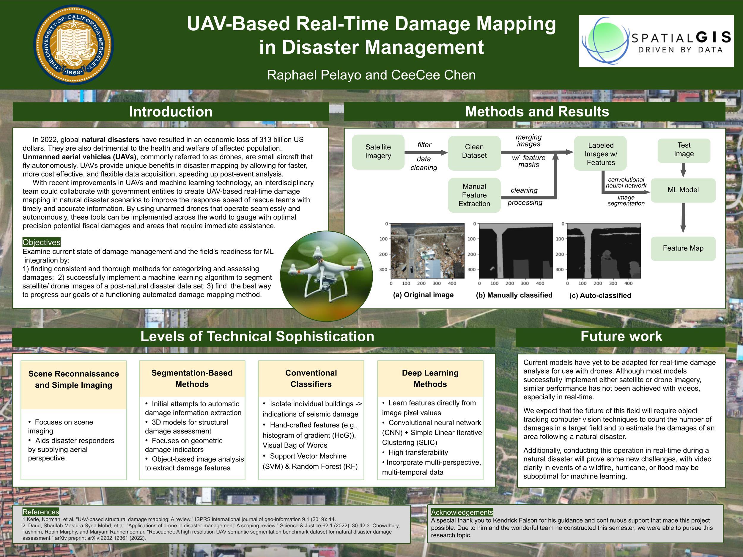
In working in the emergency management space, we are using tasks to use imagery for drones and aerial imagery to detect damage assessments of large areas of interest. The need to be able to detect the amount of debris and calculate the amount of damage post storms such as hurricanes, tornadoes, and earthquakes. We would like also would like to create the ability to create digital twins of all damaged structures.