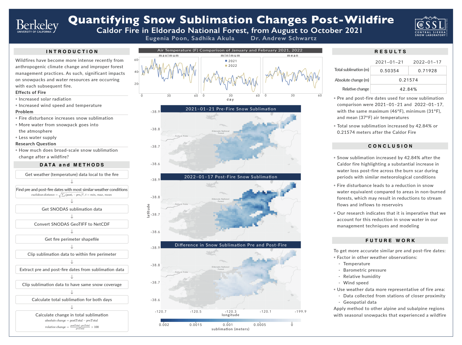
Wildfires significantly change hydrological processes within a catchment. Burn areas are known to increase temperatures, sunlight, and wind speeds that has been shown to increase evaporation up to 15 years after the burn has occurred. This goal of this project is to develop a method for quantifying pre- and post-burn evaporation (both rate and mass) in areas affected by wildfire using satellite products similar to those on GOES, LANDSAT, and the GPM. This may include using multiple products such as temperature, wind speed, and specific humidity to develop evaporation quantities. Project will ideally use either Python or R for processing.

Term
Fall 2022
Topic
Environment
Featured
Off
