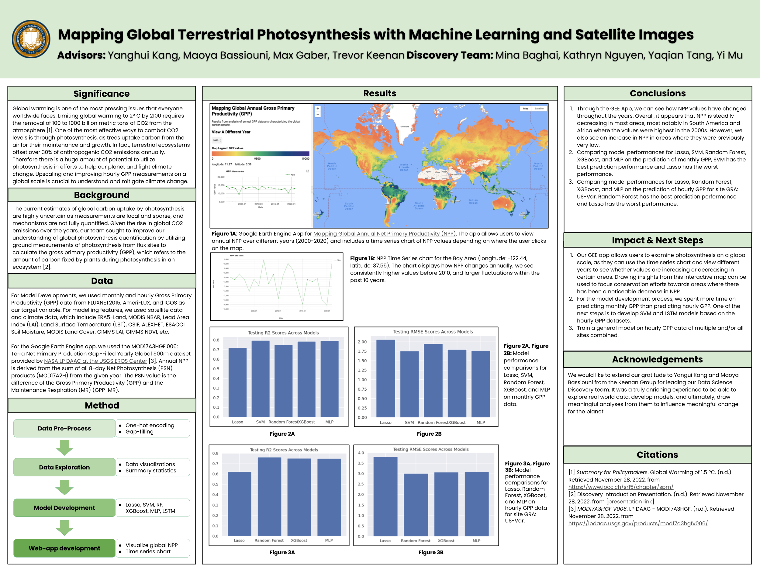
Each year, terrestrial ecosystems offset more than 30% of anthropogenic CO2 emissions. Atmospheric CO2 is sequestered by plants mainly through photosynthesis. However, current estimates of global carbon uptake by photosynthesis are highly uncertain, albeit necessary for understanding the fate of our future climate. This project aims to improve global photosynthesis quantification by combining machine learning, ground-based measurements, and remote sensing images. We will apply advanced machine/deep learning techniques to upscale photosynthesis measurements made by globally distributed micro-meteorological towers and produce wall-to-wall maps with the help of satellite images. We will build a web application for users to visualize, explore, and download our global photosynthesis maps. Students who join this project will gain experience 1) using machine learning to answer scientific questions, 2) analyzing geospatial data using various software and APIs including Google Earth Engine, and 3) developing data visualization tools and a web app.